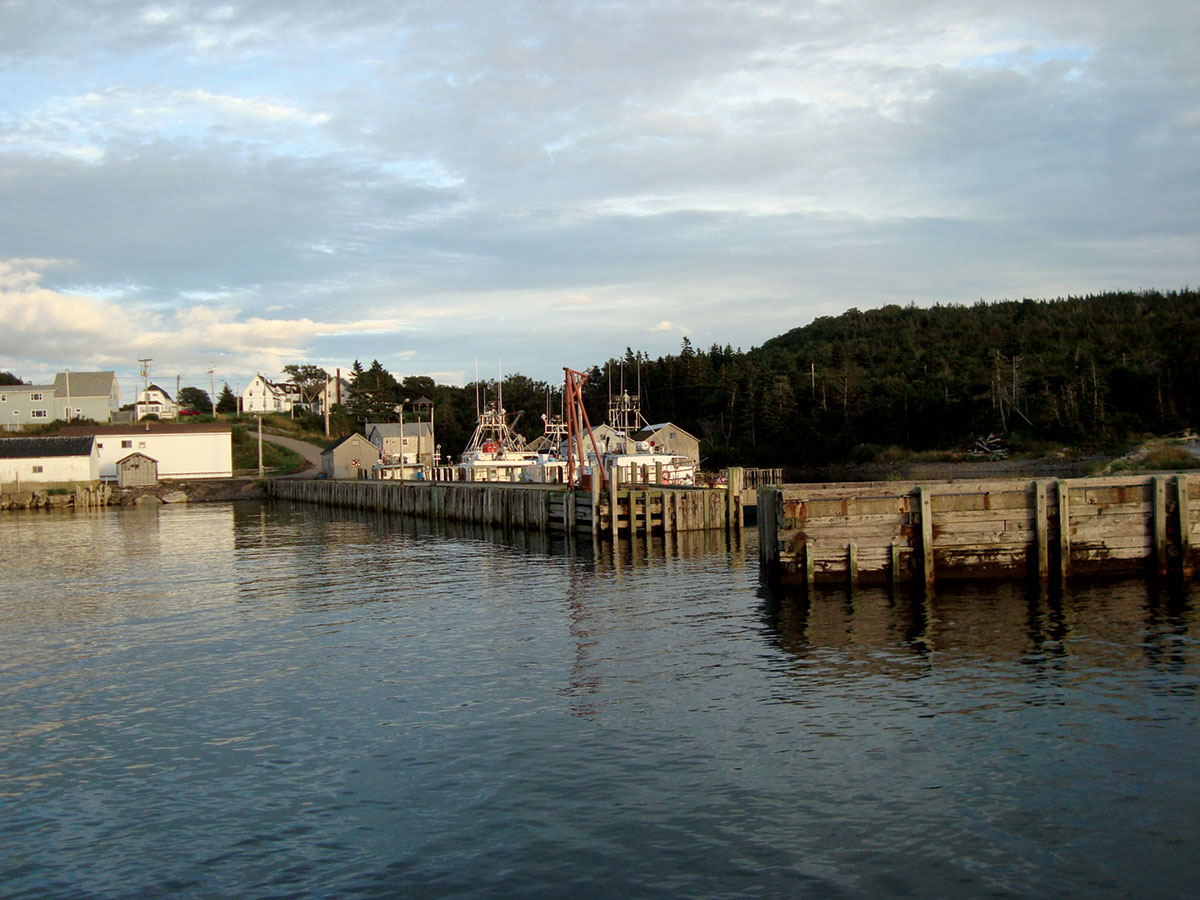
The Centreville shore.
Canada is a country made up of curious bits of geography, like Digby Neck. Given its unusual name, Digby Neck should be more famous than it is. But the tiny Nova Scotia peninsula is located on the other side of the province from the picture-postcard-friendly Cape Breton, and it’s beyond the pretty Annapolis Valley, where people take day trip drives from Halifax to see quaint towns and perfectly bucolic farms. So notoriety eludes the Neck.
The Neck is a rough, often scrubby, narrow spine of land—an extension of the North Mountain of the Annapolis Valley, along the Bay of Fundy as it gives way to the Atlantic Ocean. It’s separated from the main rump of southwestern Nova Scotia by the equally long and narrow St. Mary’s Bay. There’s only one road running the length of the Neck, beginning in Digby, a town of about two thousand. Digby is where people on the Neck are referring to when they say they’re “going into town.” The nearly hour-long Neck drive ends in East Ferry, where cars are shuttled to Long Island for more driving, then another ferry ride to Brier Island, which may be as close to the end of the known world as I’ve ever been.
Along the way, the fast and bumpy highway rolls with the mountains, cutting close to the sea on a few occasions, but managing mostly to stick to the interior—quite a feat, considering how narrow the Neck is. To get to either coast there are dead-end roads leading to tiny fishing villages, like Gulliver’s Cove, or practically unpopulated ones, like Griffin Cove. Even on the most brilliant sunny day the fog can roll in fast and thick, reducing visibility to almost nothing.
Halfway down the Neck are two villages, ten minutes apart: Centreville, spread along Trout Cove Road, rolling down to the Bay of Fundy, and Sandy Cove, a village spread across the Neck between two rather spectacular beaches that, like the entire coast here, are subject to massive tides. Though buffeted by the same economic forces, and even though they’re so close to each other, they are very different places.
Centreville is where one half of my family is from. Grandma still lives in the house my great-grandfather built on the Loyalist plot of land given to our ancestors during the American Revolution. Unlike Grandma, her kids have moved on. As is the case with many who grew up here, they all moved away in the nineteen-sixties, up the valley, to Halifax or, in my mom’s case, Windsor, Ontario. The brain and human drain on places like Centreville is a typical rural story.
To walk from the highway along Trout Cove Road to the bay is to embark on a real and imagined journey, with the ghosts of what once was all around. Centreville, and a lot of the Neck, is not the joyous fiddle-playing, foot-stomping land of kitchen parties most outsiders picture when they think of Nova Scotia. Unlike Cape Breton or the South Shore, this corner of the province was originally dominated by Baptist and United Church congregations that, while often playing central roles in the community, did not much approve of fun. Though they didn’t exactly suffer the Protestant-heavy repression depicted in Lars von Trier’s Breaking the Waves, there were reasons apart from economics for why Mom and her siblings left the Neck.
There’s a sense of lost urbanity to Centreville. Though tiny, there were once three stores (all have since closed) located quite close to the road. The two churches were also across the road from one another, set just a metre or two back from the pavement. Concrete footings and front stairs are all that remain of an old one-room schoolhouse, and further down the road there once was an event hall. Along the way are a mix of solid old homes and cheaply built dwellings. Some are lived in year-round, others have seasonal residents, and some aren’t lived in at all, victims of the shrinking village population.
Centreville’s most urban spot was down at the shore, where three wharves once sheltered a sizeable fishing fleet, and the attendant fish houses on land were clustered tight and thick. But a fire some forty years ago left only a handful of those buildings standing, serving the half-dozen or so fishing vessels that still use Centreville regularly. This village, far away from the rust belt, had much in common with mid-western American and Canadian industrial towns that saw their economy largely evaporate. “The fish,” as they say around these parts, “isn’t what it used to be.”
Down the road, in Sandy Cove, the story is different. Though also home to a fishing fleet, Sandy Cove has been more adept at replacing that shrinking economy with another: summer tourism. Always a place people from Halifax or New England came to visit, the village today is a mix of locals and out-of-towners, some of them artist types who lend Sandy Cove a smaller version of the theorist Richard Florida’s creative-class economy. Many locals are engaged in taking care of properties for seasonal visitors, providing locals with money unrelated to the uncertain fishery.
One summer resident, Sarah MacLachlan, the president of House of Anansi Press, in Toronto, along with her partner, the journalist Noah Richler—both regular visitors to Sandy Cove for some time—recently bought a sprawling house known locally as “Paul Gidney’s house,” because Paul Gidney used to live in it. Life-long Sandy Covers, Gidney’s family owned the house for generations, before he sold it to MacLachlan, who has plans to turn it into an artist and writing retreat. It’s not without precedent: the house at one point was a hotel, where my great-grandmother from Whale Cove, up the Neck, worked as a maid in her teens at the turn of the last century. MacLachlan recently found old guest books from the nineteen-thirties containing signatures of writers from New York and elsewhere. There’s much potential here. The next Cape Breton.
Back in Centreville there is still much life, and even fun, but no immediate replacement of what was lost—either its economy or residents. The memories of people who once lived there, like my mom, and people who still do, like Grandma, are near-corporeal ghosts that live among the present inhabitants. The idea of the place when it was at zenith (maybe the nineteen-fifties, maybe 1900, maybe an amalgam of past dates) is as much a part of the landscape as what’s there now. Every walk becomes a past-filled conversation about who lived where and what used to be.
It’s not unlike the 1943 children’s novel Fog Magic, by Julia L. Sauer, an America librarian and writer who also summered up the Neck, in Little River. In the novel, a young girl, Greta Addington, walks through a decaying fishing village based on the Neck’s White’s Cove. But when the fog rolls in, she’s also able to wander the area back when it was a going concern and talk to the residents. The fog of memory can nearly be as strong in Centreville, as these stories from the past I’ve heard so many times are as much a part of the area I know as my present-day experiences are when I visit. The trick is to see if some of the Sandy Cove economic magic can spread to Centreville, and perhaps start to crowd out some of the old memories with new ones.
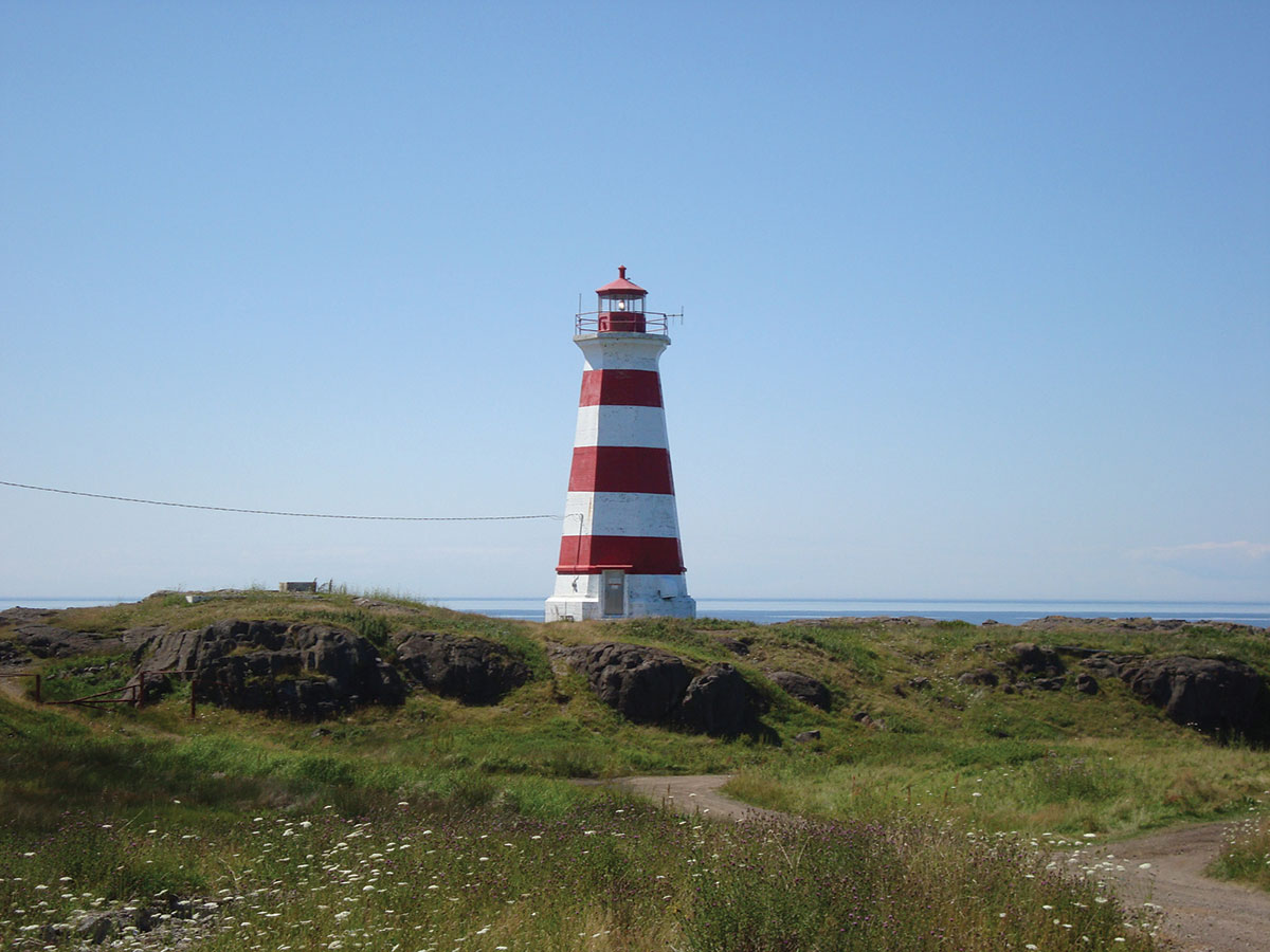
A lighthouse on Brier Island, at the Neck’s end point.
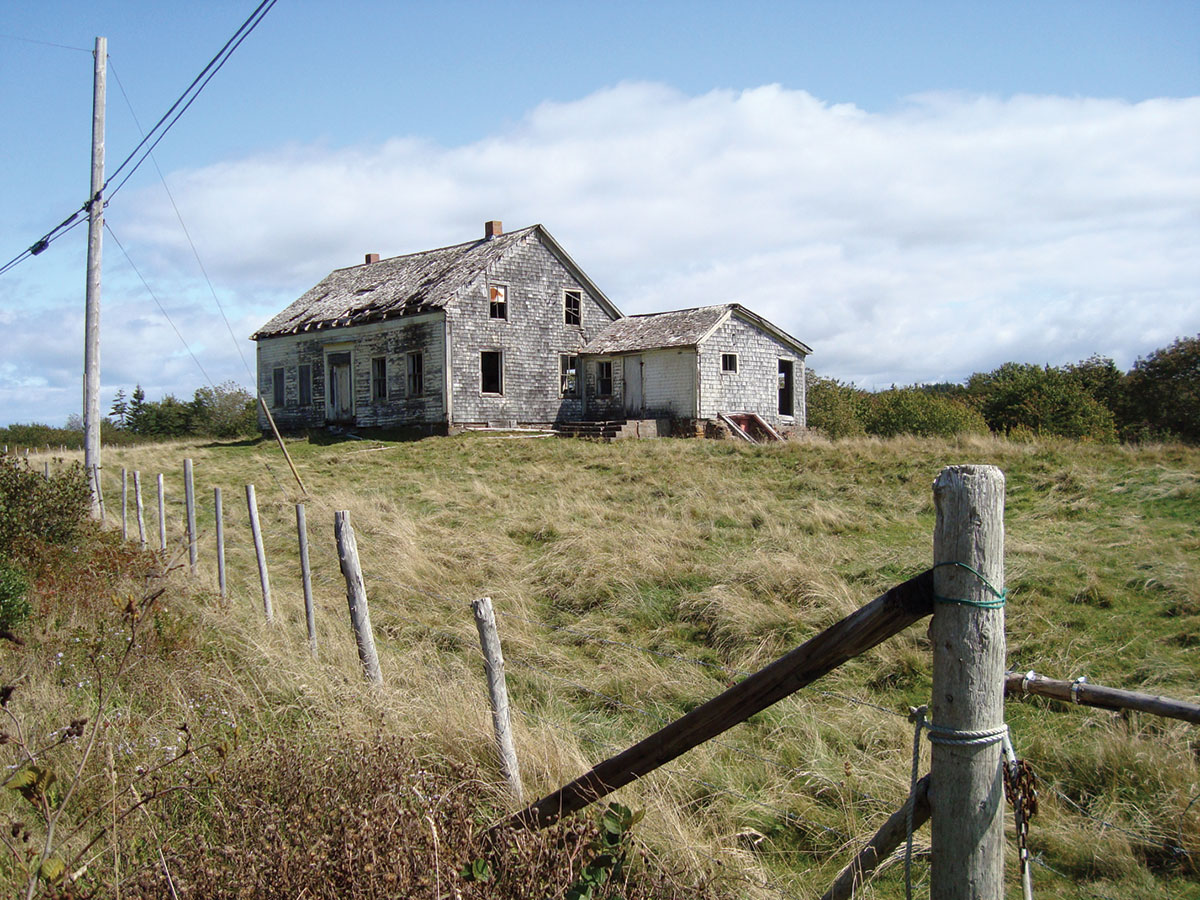
One of Digby Neck’s abandoned homes, near Tiddville.